 |
| Monck Road |
 |
| Baptiste Lake |
Should you be in any way interested, you might search the blog for Old Hastings Road. Here's a starting point.

The week in the Hastings Highlands included daily back-roads drives and regular hikes. I finally visited all the communities on all the roads we'd had to postpone visiting, on our regular commutes between Belleville and North Bay, prior to our own settling here on the Front years ago. Evocative names, and roads, and heaps of history. Today rural hideaways and cottages of all sizes replace the settlers' hand-hewn homes and hopeful barns of the mid-1800s.

The week in the Hastings Highlands included daily back-roads drives and regular hikes. I finally visited all the communities on all the roads we'd had to postpone visiting, on our regular commutes between Belleville and North Bay, prior to our own settling here on the Front years ago. Evocative names, and roads, and heaps of history. Today rural hideaways and cottages of all sizes replace the settlers' hand-hewn homes and hopeful barns of the mid-1800s.
What links all these roads and experiences and the history of the area together for me is an exceptional book. I've read Your Loving Anna, by Anna Leveridge half dozen times, and given away copies. Should you want to spend several hours in the shoes (and hopeful heart) of English settlers transplanted into the bush near Coe Hill in the early 1880s, this is the book for you. The book consists mostly of letters written by Anna Leveridge from her shack in the forest, to her mother at home in England. Despite the struggles and privations of her life, it is a hopeful and joyful read. Can you say, character?
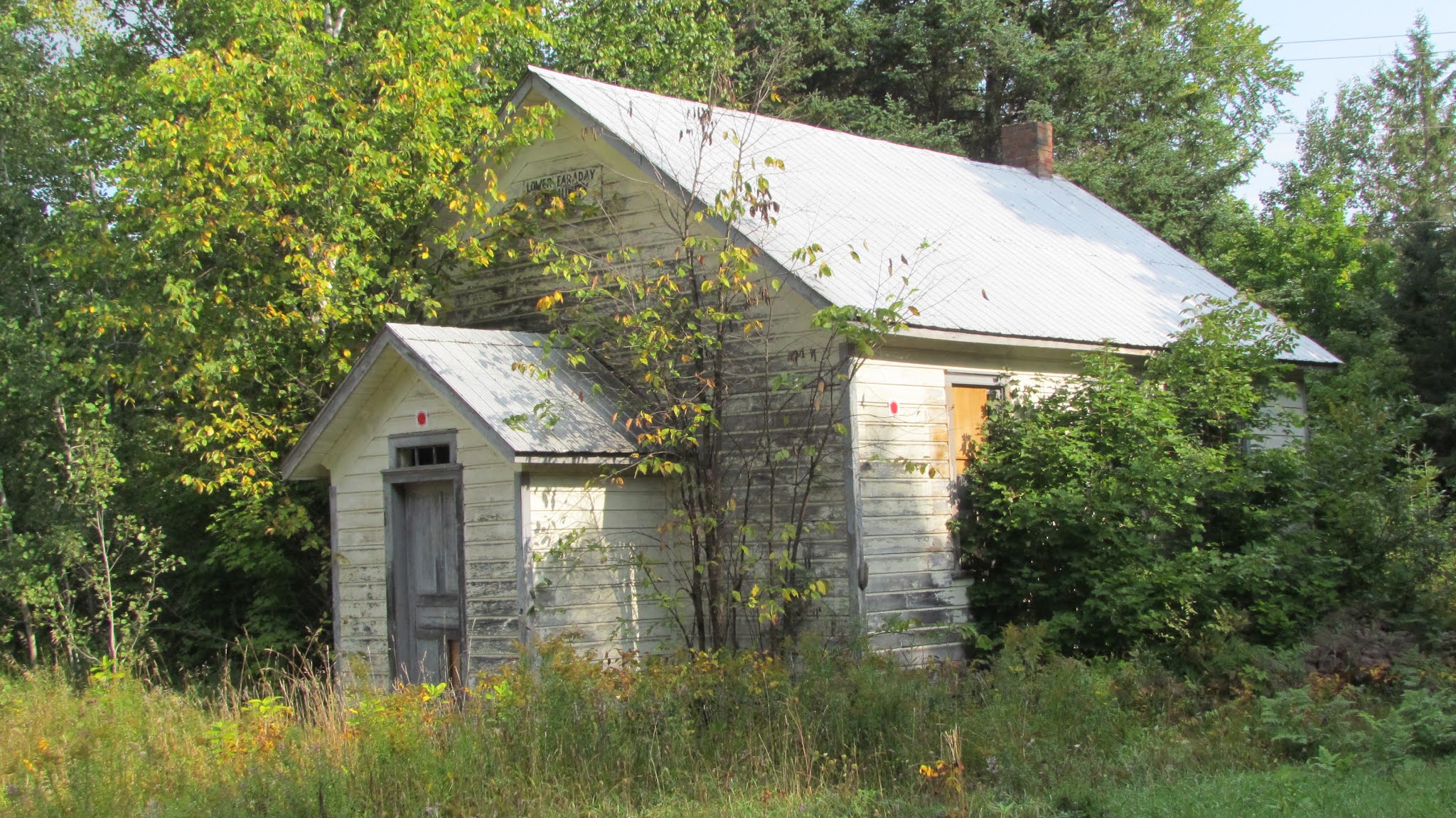 |
| Lower Faraday School |
On my final day, my return trip to the city (one might think I was delaying the inevitable, and one might be correct) I travelled several northern settlement history rabbit-holes - Lower Faraday Road, the Ridge Road, and the Old Hastings Road (the section between McGeachie Lake Road and Ormsby (where I stopped for a chat with Lillian at the Old Hastings Mercantile... and a bit of restorative retail therapy.)
Incidentally, I met Lillian years ago while I was writing for Country Roads magazine; editor Nancy Hopkins had asked me for an article on General Stores. The issue came out in 2012 Sadly, Nancy died earlier this year, and the magazine is no longer. A sad loss, both of a great magazine and of a much-loved champion of Hastings County.

 |
| Lower Faraday Road, deep forest |

At the intersection of White Church Road and Lower Faraday, I came upon this humble white frame church. I read somewhere that it had been used as a community library in more recent time. Imagine the hopes and efforts of the fledgling community, building this simple structure to house their deep faith in God and the future.
 |
| now would you call this historic beauty The Gut? |

I love just motoring on, uninterrupted by map consultations, until I discover for myself how roads connect and assemble my own mental map - ah, this is a familiar place just off Highway 62! So, since I'd come upon them, I walked the trails at the McGeatchie Conservation area on Steenburg Lake. I first visited in 2012 with Dave Golem, local councillor and McGeatchie CA enthusiast, on another assignment for Country Roads.


Before I left on my Baptiste Lake sojourn, I contacted area poet Kathy Figueroa, whom I met in my Al Purdy A-frame Association volunteer days; Kathy read at the first Purdy Picnic back in 2014.

I suspected she might know if there were a book about the area, a sort of back roads driving tour resource. And Kathy did. She recommended Touring the Past by Bob Lyons. Published by KirbyBooks, a fine local publisher of area history, and written by a well-known Bancroft Times columnist and author with an eye for history, the book made for delightful reading, and proved a great guiidbook. I recommend it! I picked up my copy at Bancroft's deservedly famous Ashlie's Books.
So, now you have all you need for your trek to the near North. Since Baptiste Lake has already called a time or two, we may run into each other (ahem) on one of the back roads of North Hastings County next summer.


